Crannog 10 Loch Awe[click on graphics for larger view in new window] |
Location: Opposite Loch Awe House
Map reference: NN 121 265
Date of Survey: 2 October 1972
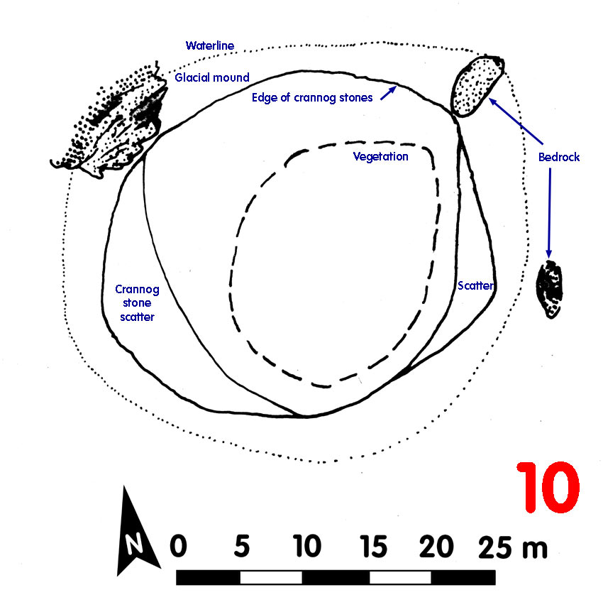
Loch level OD: 35.357 m
Highest point of crannog OD: 37.687 m
Top to bottom of crannog: 1.73 m
Overall spread: 32 m x 26 m
Usable area: ca 21 m x 20 m
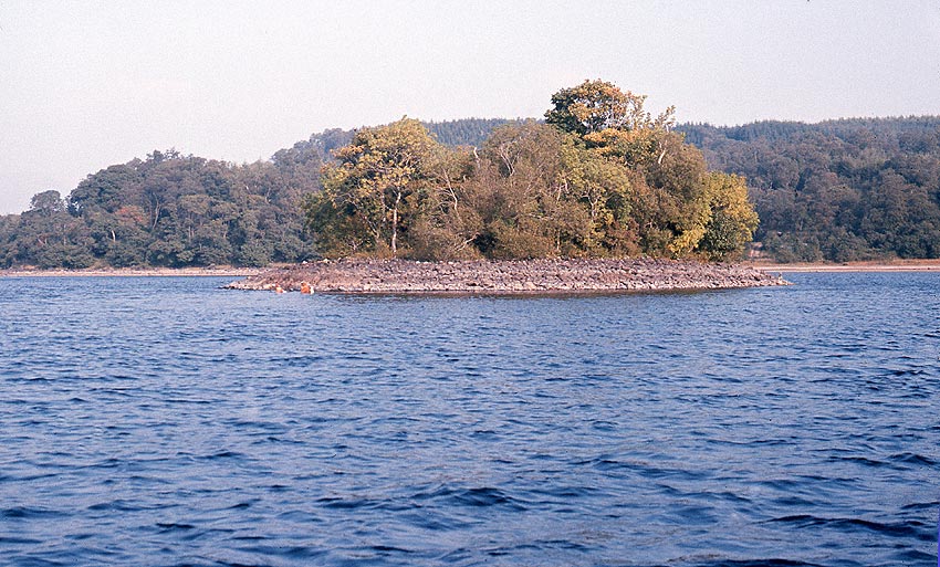
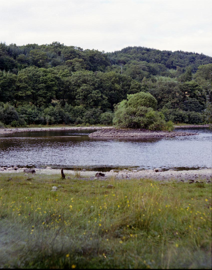
Description (1972): Built on natural mound with bedrock outcrops to NW, NE and N. Heavy vegetation and mature trees. All except one corner was out of the water, sitting on the glacial subsoil which was also visible above the water. Small cairn on top of the crannog.
Crannog steep-sided, particularly on E side.
Finds:
Dating:
Post-1972:
CLICK TO ENLARGE
Approaching Crannog 10, it looked more massive than others perhaps due to the heavy tree cover. It turned out to be the highest crannog in the loch, helped by the possibly modern cairn on top, and one of the largest